
District Overview
Sri Potti Sriramulu Nellore District, located in the southern coastal region of Andhra Pradesh, is known for its rich history, vibrant culture, fertile agricultural lands and scenic coastal landscapes. The district is bordered by the Bay of Bengal on the east and is surrounded by Prakasam District, Tirupati District and the Veligonda Hills.Nellore combines historical heritage with modern development. Its temples, coastline, rivers, agriculture, traditional communities and growing urban centres make it an important district in Andhra Pradesh.The district covers 10,439.75 sq. km and had a population of approximately 24.69 lakh according to the 2011 Census.
District Towns & Urban Centres
Nellore District is home to several vibrant towns and urban centres that contribute to administration, commerce, agriculture, education and cultural development.
Nellore
The district headquarters and a major urban centre known for administration, commerce, education and cultural heritage.
Kavali
An important coastal town and commercial centre located in the northern part of Nellore District.
Atmakur
A prominent town surrounded by agricultural and rural landscapes, serving as an important administrative centre.
Kandukur
A major town with strong agricultural and commercial activity, serving as an important administrative centre.
Allur
A Nagar Panchayat contributing to the local rural-urban economy and serving the surrounding communities.
Buchireddypalem
A growing urban centre with strong connections to the surrounding agricultural areas and local communities.
Population Chart
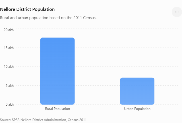
According to the 2011 Census, Nellore District recorded a total population of approximately 24.69 lakh. Of this, around 17.64 lakh people lived in rural areas, while approximately 7.05 lakh lived in urban areas. The district recorded a population density of 236 persons per sq. km, with a sex ratio of 983 females per 1,000 males
Population Highlights
- Total Population: 24.69 lakh
- Rural Population: 17.64 lakh
- Urban Population: 7.05 lakh
- Population Density: 236 persons/sq. km
- Sex Ratio: 983 females per 1,000 males
- SC Population: 5.05 lakh
- ST Population: 2.15 lakh
District Statistics
| Statistic | Details |
|---|---|
| 📍 District | Sri Potti Sriramulu Nellore |
| 📐 Area | 10,439.75 Sq. Km |
| 👥 Population | 24.69 Lakh |
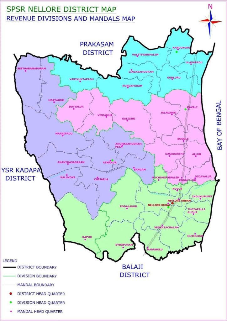
| 🏘️ Revenue Divisions | 4 |
| 🏛️ Revenue Mandals | 38 |
| 🏘️ Gram Panchayats | 722 |
| 🏙️ Municipalities | 3 |
| 🏘️ Nagar Panchayats | 2 |
| 🏢 Municipal Corporation | 1 |
| 🌾 Villages | 735 |
| 👩 Sex Ratio | 983 females / 1,000 males |
| 👥 Population Density | 236 persons / Sq. Km |
Area Measurement
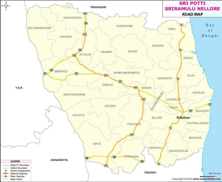
Sri Potti Sriramulu Nellore District covers an area of approximately 10,439.75 square kilometres in its present configuration. The district occupies a significant stretch of south-eastern Andhra Pradesh and extends along the Bay of Bengal. The eastern side of the district is defined by the Bay of Bengal, while the district is connected with neighbouring regions through an extensive road and rail network.
History of Nellore District
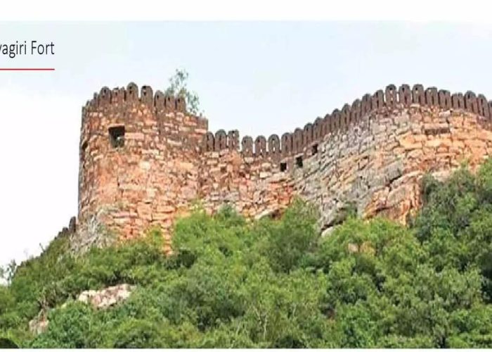
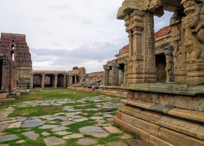
Nellore District situated in the South Eastern portion of the state with a coastal length of 163 KM bounded by Bay of Bengal on the East. The district was known as Vikrama Simhapuri until 13th Century and later it came to be referred to as NelloreHistorically the district was under the rule of Mouryas, Sathavahanas, Pallavas, Cholas, TelugU cholas, Kakateeyas, Pandyans etc. The great Telugu poet Tikkana Somayaji translated 15 parvas of Sanskrit Mahabharata into Telugu in Nellore.It is supposed that Nellore was situated in Dandakaranya forests into which the Aryas first penetrated as adventurous sages with the rise of the Mouryan Empire Nellore also seems to have under its influence and was part of the Ashoka Empire in the 3rd century B.C. It was next included in the Pallava Dominion between the fourth and sixth century A.D.Nellore district formed part of the composite Madras State till 1st October, 1953. On 1st November 1956 when the states were reorganized on a linguistic basis, this district came under the Andhra Pradesh State.The name of Nellore district has been changed as Sri Potti Sriramulu Nellore District on 4th June, 2008.
Revenue Administration
Revenue Administration is one of the important pillars of district administration in Sri Potti Sriramulu Nellore District. It is responsible for the administration and management of land records, revenue matters, land assignment, land acquisition, welfare-related activities, disaster relief, civil supplies, elections and several other government services.The Revenue Department maintains a direct connection with citizens through the Collectorate, Revenue Divisional Offices and Tahsildar Offices. The administration is structured from the district level down to revenue divisions, mandals and villages to make government services accessible to people.For administrative convenience, the district is divided into Revenue Divisions. Each division is headed by a Revenue Divisional Officer (RDO).
The current official Revenue Divisions page lists:
1. Nellore Revenue Division
Headquarters: Nellore
2. Kavali Revenue Division
Headquarters: Kavali
3. Gudur Revenue Division
Headquarters: Gudur
4. Atmakur Revenue Division
Headquarters: Atmakur